Itinerary
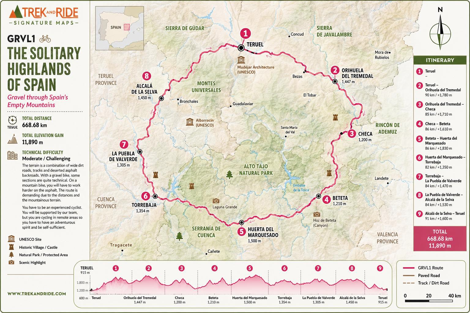
Day 1. Teruel
Arrival at Teruel on your own behalf. From Madrid there is a direct bus and from Valencia there is a direct train to Teruel.
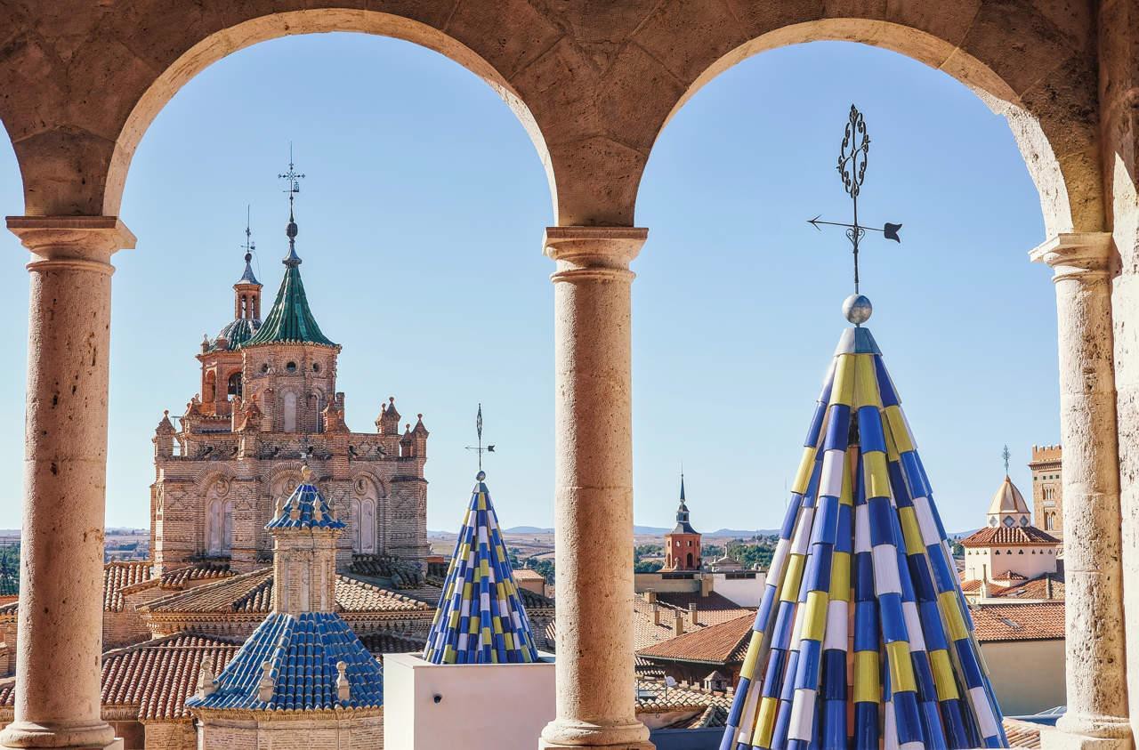
Teruel might be one of Spain’s smallest provincial capitals, but it packs an incredible punch. It is the undisputed capital of Mudéjar architecture (a breathtaking fusion of Gothic/Romanesque and Islamic styles).
Day 2: Teruel to Orihuela del Tremedal
Distance: 86,3 km / +1773m / – 1247m
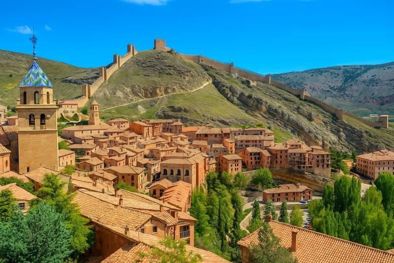
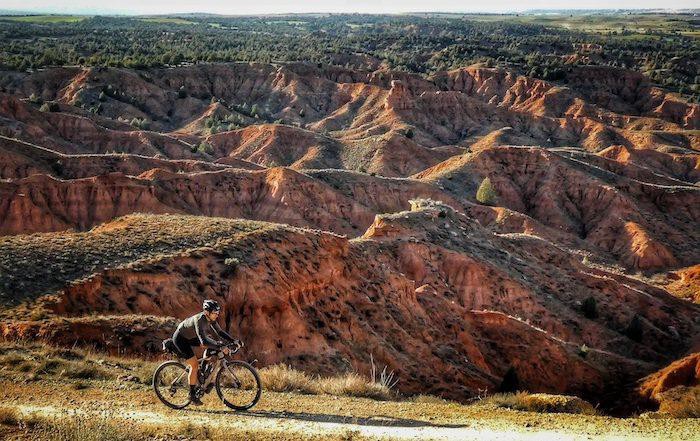
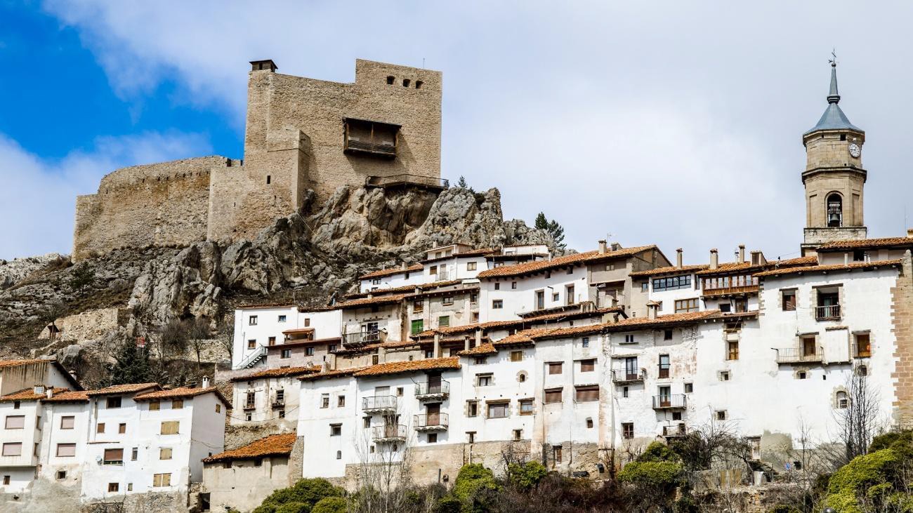
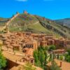
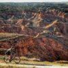
The route departs the capital of Teruel, known for its Mudéjar architectural monuments, including the Cathedral of Santa María de Mediavilla and the towers of El Salvador and San Martín. The track quickly transitions into an arid landscape of undulating red clay hills and limestone canyons. Significant geographic landmarks on this section include the Laguna de Bezas and the rock formations of the Peña de la Cruz. Mandatory visit is the medieval fortified village of Albarracín, situated inside a tight bend of the Guadalaviar River and characterized by its preserved defensive walls and pink-hued stone architecture. The stage culminates in the mountain town of Orihuela del Tremedal, located at 1,447 meters above sea level, surrounded by dense forests and with a perfect sense of isolation.
Day 3: Orihuela del Tremedal to Checa
Distance: 85,4 km / +1159m / – 1243m
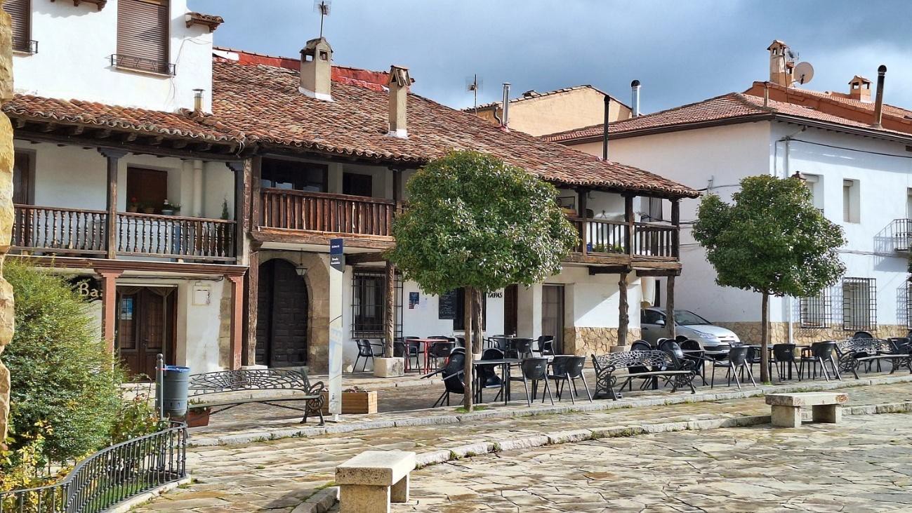
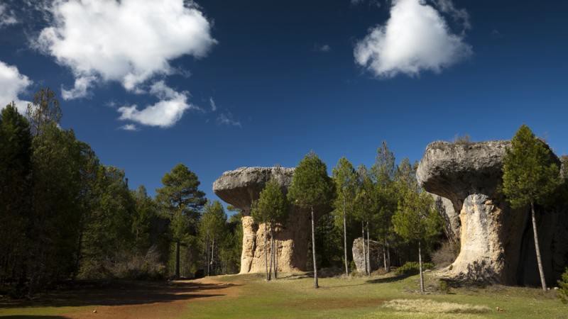
From Orihuela del Tremedal, the path climbs into the Montes Universales range, characterized by dense pine forests and cold highland plains. The route passes near Griegos, one of the highest altitude municipalities in Spain. The landscape features extensive karst topography, limestone pavements, and subterranean drainage networks. The stage ends in Checa, a picturesque mountain village surrounded by nature and tranquility.
Day 4: Checa – Beteta
Distance: 107,5 km / + 1296m / – 1468m
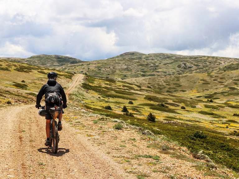
Departing the mountain village of Checa, situated at an altitude of approximately 1,200 meters, the track follows the course of the Cabrillas River valley, surrounded by dramatic limestone walls and dense pine forests. The initial terrain consists of wide, hard-packed gravel trails that climb gently toward the western edge of the Alto Tajo Natural Park. As the route crosses the provincial boundary from Aragon into Castile-La Mancha, the landscape opens into the expansive, arid parameras—high, wind-swept limestone plateaus characterized by low-lying juniper scrub and exposed rock.
The route then trends southwest toward the deep gorge of the Masegosa and Cuervo river basins, tracking along smooth gravel forestry roads that cut through dense stands of black pine. Geologically, this section is defined by intense karstic activity; the trail bypasses several large depressions and limestone sinkholes.
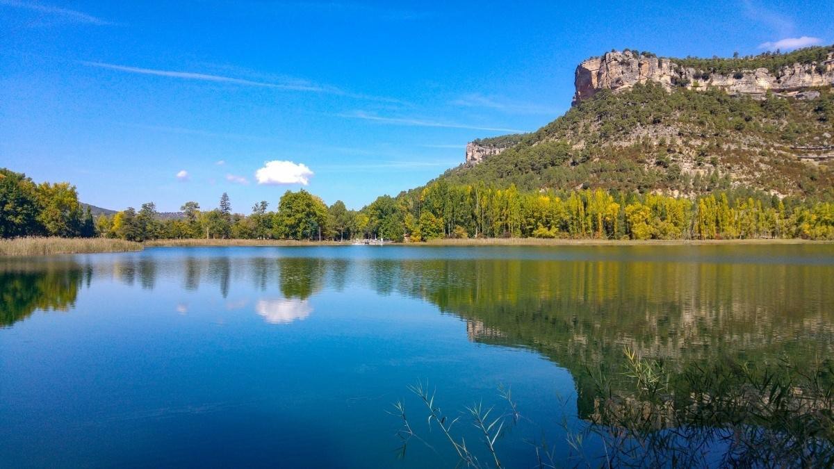
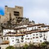
Approaching the final segment of the day, the path descends steeply through a series of sweeping gravel switchbacks into the striking Beteta Strait (Hoz de Beteta), a deep, precipitous canyon carved by the Guadiela River where vertical rock walls rise over 80 meters above the canyon floor. The day concludes with a short, paved climb out of the canyon floor to the fortified cliffside village of Beteta, located at 1,210 meters of altitude, marked by the ruins of the medieval Castle of Rochafrida dominating the skyline.
Day 5: Beteta – Huerta del Marquesado
Distance: 92,1 km / + 1329m / – 1256m
Today’s ride through the core of the Serranía de Cuenca Natural Park is one of the loop’s most demanding segments due to significant climbing. Departing the cliffside fortress village of Beteta, a paved approach leads toward El Tobar, allowing for a short detour to the deep, karstic Laguna Grande. The track then heads south to Santa María del Val, running alongside the steep limestone gorges of the Embalse de la Tosca.
Transitioning onto unpaved forestry tracks, the route initiates a sustained climb into the protected highlands. This isolated plateau, averaging 1,500 meters above sea level, features dense pine forests rich with large wildlife like wild boar and deer, alongside unique karstic topography filled with massive torcas (sinkholes). With zero infrastructure outside of remote forestry shelters like the Refugio de la Halconera, the route traverses these wild, undulating highlands before descending through alpine meadows to finish in the mountain village of Huerta del Marquesado.
Day 6: Huerta del Marquesado to Torrebaja
Distance: 77,9 km / + 1070m / – 1594m
From Huerta del Marquesado you quickly follow a prolonged, isolated stretch through the southern limits of the Serranía de Cuenca. The track consists almost entirely of unpaved forest roads and compact gravel, climbing onto a high, desolate limestone plateau over 1,400 meters in elevation. The landscape features dense pine forests (Pinus nigra) that gradually give way to open highland pastures and deep valley depressions. There is no intermediate municipal infrastructure or water access along this high plateau segment.
The route crosses the provincial border from Cuenca into the region of Valencia, specifically entering the Rincón de Ademuz, a historically isolated geopolitical enclave. At this point, the topography changes significantly. The dense forests thin out into a rugged, badland-style landscape defined by stark clay ravines, gypsum hills, and eroded terraces. Notable architectural sites include the traditional stone architecture of small valley hamlets such as Castielfabib, which features a prominent 12th-century fortress-church built directly into a precipitous cliff face over the Ebrón River.
The final stretch of the day follows gravel tracks along the Ebrón and Turia river valleys, transitioning into agricultural land dominated by fruit orchards and irrigated terraces. The track maintains a steady downward trajectory until it reaches the valley floor, terminating at Torrebaja, a low-elevation town situated at the confluence of the Turia and Ebrón rivers at roughly 760 meters above sea level.
Day 7: Torrebaja – La Puebla de Valverde
Distance: 66,7 km / + 1689m / – 1308m
Departing the fertile Turia River basin in the Valencian enclave of Torrebaja, the route transitions into a sustained climb up the rugged flanks of the Sierra de Javalambre massif. The terrain shifts from loose agricultural tracks to rough gravel roads, passing through narrow limestone gorges and the remote stone villages of Alobras and Tormón. As elevation increases, the landscape transforms significantly, moving from Mediterranean oak groves into dense black pine forests, before finally giving way to an exposed, wind-scoured alpine tundra dominated by creeping dwarf juniper. This high-altitude plateau offers vast, unobstructed views across the Iberian System. The day concludes with a descent into La Puebla de Valverde, a historic walled town defined by its preserved medieval gateway arches and the 16th-century Church of Santa Emerenciana.
Day 8: La Puebla de Valverde – Alcala de la Selva
Distance: 93,6 km / + 1935m / – 1665m
The route departs the medieval walled town of La Puebla de Valverde, heading northeast to cross the open plains of the Mijares River basin before beginning a steady, sustained climb into the heart of the Sierra de Gúdar. The underfoot conditions transition from smooth agricultural gravel roads to rougher, more technical forest tracks as the path ascends through changing ecological zones. The landscape evolves from low-lying Mediterranean oak groves and terraced fields into dense, high-altitude forests of Scots pine and black pine. The track winds through limestone valleys and deep barrancos, passing near Mora de Rubielos, which is dominated by its massive 14th-century Gothic military castle. Continuing upward into the cooler mountain air, the day concludes in Alcalá de la Selva, a historic village defined by its traditional tiered stone architecture clinging to the hillside under the silhouette of its medieval fortress ruins.
Day 9: Alcala de la Selva – Teruel
Distance: 58,5km / +891m / – 1339m
The route departs the hillside village of Alcalá de la Selva, immediately tackling a rigorous, high-altitude climb through the dense pine forests of the upper Sierra de Gúdar. The rough forest tracks scale the subalpine terrain, passing near the highest elevations of the massif and the Peñarroya peak area, where the landscape opens into vast, wind-scoured mountain pastures. From this elevated plateau, the route transitions into a long, continuous westward descent, utilizing a combination of fast gravel tracks and the smooth, packed surface of the Ojos Negros Greenway, a converted historical railway alignment. The rugged alpine scenery gradually flattens into an arid landscape of reddish clay hills and limestone canyons as the track approaches the Turia River basin. The loop concludes back in the provincial capital of Teruel, finishing among the iconic Mudéjar architectural monuments of the historic old town.
Day 10: Teruel – Farewell to the Wilds
After an unforgettable expedition through the quietest corners of Spain, our epic journey draws to a close. Enjoy one last breakfast in historic Teruel, swap your favorite stories from the trail, and bid farewell to the Empty Mountains—until the next great adventure calls